The Cairngorms are the mountain range south of Inverness in Scotland. I was in Scotland for 2 weeks doing various things, including Paddleboarding the Great Glen, but I’m going to restrain this post to my hiking adventures.
I’d never stayed in a Bothy, so I decided I would go and find one. I had a guide book and went to the one listed as close enough to visit easily, on the Balmoral Estate of all places. The bothy was opposite the hunting lodge which apparently the queen does genuinely use sometimes!

It was a busy night in the bothy! The TGO Challenge was on so I met a whole host of people who annually walk the Scottish Coast-to-Coast, self-supported and self-navigating. Some of them were well over 70 and had been doing it for years, deciding that they wanted to do a more challenging route this year and choosing to go up as many Munroes as they could!
Having given bothying a go, and finding myself with a reasonably good weather window. I set off to walk the Cairngorm 4000s, which is all the mountain tops in that mountain range, over 4000ft tall. There isn’t really an official route, but I found a gpx online and then applied it to the map to see what I’d be collecting.
I parked up at the bottom of the train, but discovered that you aren’t allowed to walk from the top of it for ecological reasons, so had to hike all the way up, almost entirely within sight of the train tracks anyway. I was a bit concerned when a German couple hiked up past me in jeans with a pamphlet as their map, but it appears that the rangers at the top of Cairngorm Mountain had the same thoughts as they were quick to ‘chat’.

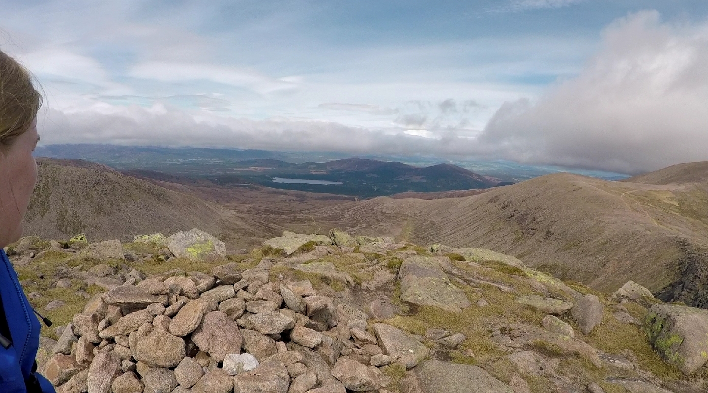
I’m not a fan of there-and-back trips, but because of the way that path came up the hill, I had to turn around and go straight back down that same path to head off in the right direction as originally planned.
Despite being May, there was still snowy patches on the ground, and the weather went from really foggy, which made navigation difficult, to really sunny, but the breeze still made it quite cool.

It turns out that the Cairngorms are for the most part on a single plateau, with a river running through the middle (Lairig Ghru). But this doesn’t make the area flat, with saddle areas still being over 1000m.
After Ben Macdui there was a steep and long scramble all the way down to the river made up of large boulders. At this point the weather had really closed in. Scrambling with a heavy backpack was a struggle and there were a number of times where I scared myself. It wasn’t long before I was tired and frustrated by how little progress is felt like I was making. At about half way down the boulders stopped and it was a steep, slippery walk down a grassy slope, during which I regularly stepped in bogs. At one point I dropped my map and it fell into the stream at the bottom of the valley. As it was so steep to get down there I decided to slide, but I managed to pick up quite a bit of speed and nearly missed it as I skidded past! I managed to stop before I slid into the stream luckily, but I ripped my waterproof trousers a bit in the process.

I planned to camp somewhere along the river, but the ground was really wet so I was contemplating starting to walk up the other side to find a good spot to camp, when the clouds parted and a beam of golden afternoon sunshine shone between two of the peaks on an unexpected bothy in the perfect location.
The second day was really hot and sunny, so I had managed to use up my full aquapack by 10am. This was not ideal, but at the top of the ridgeline there were areas where the snow hadn’t melted yet, so I scooped some up into my pack and attached it to the outside so it could melt in the sun, it worked pretty well!

The first few peaks are pretty steep and bouldery underfoot, but the second half of the day included going to a few tarns further back from the edge, some parts looked like a moonscape and like nowhere I have been before.
What I hadn’t considered mentally was how tiring and how little motivation I would retain after reaching the final peak. Unlike in the ascent where I was at the top of Cairn Gorm within an hour or two, Braeriach is much further on the return which felt endless and the descent was really hard on the knees.

On the way back down I came across a chap called Kit again, who I had previously come across near Angels Peak. We got chatting about all sorts including politics, but he was lovely enough to give me a lift from the carpark he had parked in back up to where I had parked, which would have only been a mile or so, but the footpath was closed for maintenance so winding my way up the road would have taken considerably longer.

Fantastic! very inspirational
LikeLike